Skip to content
Outdoor Pitstop logoOutdoor Pitstop

Attraction · Pradelles-Cabardès · Updated on 1 November 2026.

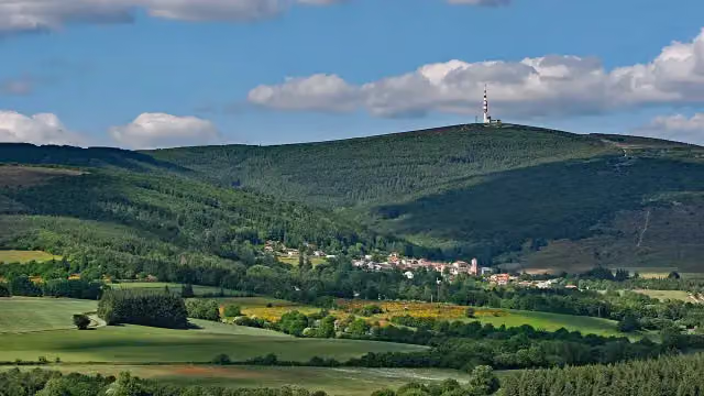
Pic de Nore in Pradelles-Cabardès

Pic de Nore is an attraction in Pradelles-Cabardès, Aude. This place has a story in the app. Within 70 m you'll find a bench.

Pic de Nore in Pradelles-Cabardès
i
Photo: Jcb-caz-11 · Wikimedia Commons · CC BY-SA 4.0View the photo on Wikimedia Commons
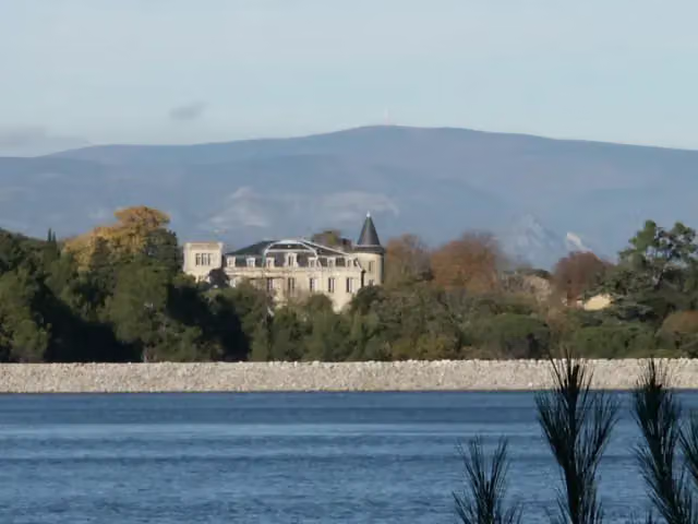
Pic de Nore in Pradelles-Cabardès, photo 2
i
Photo: Heiko at Dutch Wikipedia · Wikimedia Commons · CC BY-SA 3.0View the photo on Wikimedia Commons
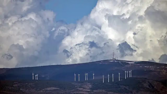
Pic de Nore in Pradelles-Cabardès, photo 3
i
Photo: Jcb-caz-11 · Wikimedia Commons · CC BY-SA 4.0View the photo on Wikimedia Commons

The story

Story · Pic de Nore

  • en
  • nl

You're standing on the Pic de Nore, or Nòra in Occitan. At 1,211 metres, this is the highest point of the Montagne Noire, the Black Mountain, in southern France. The border between two departments runs right across this summit, with the Aude on one side and the Tarn on the other. The Haut-Languedoc regional nature park starts close by.

Read the whole story in the Outdoor Pitstop app: check in at this place and it is yours (with Pro; new users are Pro for the first 4 weeks).


Photos

10 photos from Wikimedia Commons. In the app you add your own photo when you are there.

Pic de Nore in Pradelles-Cabardès
1 / 10
i
Photo: Jcb-caz-11 · Wikimedia Commons · CC BY-SA 4.0View the photo on Wikimedia Commons

Pic de Nore in Pradelles-Cabardès: highest peak of the Montagne Noire

The Pic de Nore is a mountain peak of 1,211 metres. It is the highest point of the Montagne Noire in the south of France. You will spot the summit straight away by the transmission mast, which is 102 metres tall, because radio and television signals travel out across the wide surrounding area from here. Cyclists know the mountain well too. In 2018, the Tour de France crossed the summit for the first time. You will find the Pic de Nore in Pradelles-Cabardès, in the Aude department. On the top, the border with the Tarn department runs through, and the regional nature park of Haut-Languedoc begins nearby.

The history of the Pic de Nore

The mountain is called Nòra. At the summit stands the transmitter mast that you can spot from far away. In the past, the mast broadcast analogue television, and digital channels have since been added. When the mast was built and by whom is not known to us, so we do not give a year or name here. What you see on the mountain today, and which cycling climbs end here, is described in the other paragraphs.

Toilets, drinking water and benches nearby

The nearest bench is 67 metres away. There is only one bench within 500 metres, so seating around Pic de Nore is limited. According to our map, there is no public toilet near Pic de Nore either, as you will not find one within 1 km. The same applies to drinking water: according to our map, there is no water tap within 1 km. It is therefore a good idea to take enough water with you, and to use the toilet before you set off.

Facilities near Pic de Nore

The nearest pitstop of each kind within 1 km, as the crow flies. No water point, public toilet, bike pump or honesty box within 1 km.

Explore further

Frequently asked questions

How high is the Pic de Nore?

The Pic de Nore is 1,211 metres high. It is the highest point of the Montagne Noire in the south of France.

Where is the Pic de Nore in Pradelles-Cabardès?

The Pic de Nore is in Pradelles-Cabardès in the Aude department, on the border with the Tarn. The Haut-Languedoc regional natural park begins nearby.

How high is the transmission mast on the Pic de Nore?

The transmission mast on the Pic de Nore is 102 metres high. From this mast, radio and television signals travel across the surrounding area.

How long is the cycling climb to the Pic de Nore?

The climb from Mazamet is 17 kilometres long with an average gradient of 5.7 per cent. From Cabrespine it is 17.5 kilometres long with an average gradient of 5.4 per cent. The hardest route starts from Mas-Cabardès. It is shorter but has sections steeper than 13 per cent.

Did the Tour de France go over the Pic de Nore?

Yes, the Tour de France first went over the summit of the Pic de Nore in 2018.

Are there benches at the Pic de Nore?

Yes, the nearest bench is 67 metres away. There is 1 bench within 500 metres.

The free app

All of Outdoor Pitstop, in your pocket

Find the nearest pitstop, navigate there, listen to audio tours, earn XP and make routes and lists together.

Download on the App StoreGet it on Google Play
How Outdoor Pitstop works →
The map of the app with pitstops nearby
A pitstop in the app, with a photo, a review and Navigate
Your profile in the app, with level and XP


